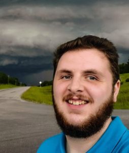
featuring Connor Mockett

Hello, everyone! Welcome back to another week of The Weather with Connor. In my last column, I said at the bottom that I’d resume talking about the final 9 days of my Chasecation to Alberta. That will have to wait, as I’d like to talk about the events of last Thursday, July 13th, instead.
July 13th was the day when a couple of tornadoes happened in Barrhaven in Ottawa, and then a tornado-warned storm made its way across the region from Vernon and across the border into Quebec, where it put down another tornado north of Montreal. I want to talk about the day leading up to that day, and my chase day.
So let’s start with July 12th, a Wednesday, the day before things hit the fan. I started to look at models in the afternoon that day and started to see things that I haven’t really seen here much at all, if ever. The model runs were hinting at an environment rarely seen in this area, due to a low pressure system crossing through the region. This system was also responsible for tornadoes in the Chicago area, so going into Thursday, the system already had tornadoes in its DNA.
Throughout the evening, model runs kept coming in, all giving the signal that July 13th would be a day to remember. I kept reading the models and thinking to myself “is this for Eastern Ontario or Oklahoma?” Obviously, it was for Eastern Ontario and we were getting set for a very dangerous day.
The next morning, I once again pulled my phone out to look things over before making my morning Facebook post. That is when I began to get a little bit of worried that something bad was going to happen that day. I knew that two major cities, Ottawa and Montreal, as well as everywhere in between, were under the gun in a significant way. So I sounded the proverbial alarm and told everyone to treat the day with respect and to pay attention to warnings and alerts.
Storms actually started very early; it was only around 9:00am when storms started to form into a line over to the west near Peterborough. Those storms would move to the east, into an environment very primed for potent severe weather. Storms then entered the Ottawa area around 11:30am, and by about 12:30-ish, a couple of tornadoes were reported in Barrhaven.
I started my chase day around that 11:30 time, but was unable to catch those tornadoes, as Ottawa was not my target area for the day. I went further east for my target, which was St. Isidore, and sat in the Esso parking lot with another chasing buddy of mine. We waited there for about 30 minutes until it was finally time to get out of the parking lot and head towards another section of the storm that had a tornado warning on it.
We traveled back west slightly before intercepting the storm in St. Albert, where it was incredibly beautiful. Don’t get me wrong, the storm was incredibly beautiful for its entire life cycle. After getting eyes on that storm, I turned back around to go back east again as it entered Casselman. Luckily for Casselman, the very strong rotation on the storm did not put down a tornado, because that rotation went right over top of town.
I then hopped on the 417 in Casselman for a short and quick trip down the highway towards the HWY 138 exit, where I got off and turned to the north for a 30 second drive until my next eastward turn. I turned east on those really nice back roads between Casselman and St. Isidore, which is probably my favourite area to chase in the entire region, and stopped to watch the storm for a couple of minutes. This is where rotation on the storm became even stronger and was very very visible to the naked eye.
I kept going east after a short stop, and then stopped between St. Isidore and Fournier. This is where rotation was at its peak, and the structure of the storm was at its peak too. I’ve never seen a storm that beautiful in this region before, it was unbelievable. I was pretty surprised I didn’t see a tornado near Fournier when I stopped on a gravel road to look at the storm, because rotation was one of the strongest I’ve seen here too. There could have been a tornado buried in the rain of the storm, but it is still unconfirmed at the time I’m writing this.
Strong rotation and a very windy storm then entered the Town of Vankleek Hill, still thankfully not a tornado though considering it would have gone right through the Town. I had to stop chasing the storm just after Vankleek Hill, mostly because I went down a dirt road and then realized that I didn’t have another east road option, and that it was either go back to where I came from, or sit where I was. Both options involved me getting hit by the storm, carefully not in the path of the rotation. I chose to just sit on that dirt road and let the storm hit me and pass.
After the storm passed, I went to the Timmies in Vankleek Hill (because why wouldn’t you get Timmies after a chase?) and met up with another chasing buddy. We then both hopped back on the 417 south of Vankleek Hill, and headed back west towards Ottawa for round 2, which ended up dying off before we got back to those storms.
Full disclosure, my storm chase on July 13th was probably my best chase ever in my 9 years of chasing. Many of my all time favourite photos were taken that day. Although an unfortunate event in Ottawa with two damaging tornadoes, which thankfully no one died from, this was a day that I will never forget.


